
Call us: (London)
0203 633 7902
For Property Developers, Facilities Managers & Commercial Landowners…
Get Planning-Ready Land Surveys - Fast, Accurate, and Built to Win Approvals
How To Get Precise, Topographical Surveys Without Waiting Weeks, Chasing Quotes, or Overpaying

RATED 4.9/5.0 On Google




REQUEST A QUOTE
Use our simple pricing tool or request a quote, get a crystal-clear cost within the hour so you can move forward without delay.
Get Booked In
We will confirm your survey date quickly, with priority slots available, keeping your planning timeline on track.
GET APPROVED FAST
Receive planning-ready survey data within days, engineered to support smooth submissions and confident design decisions.
If you're a developer, architect or planning consultant, our topographical surveys help you move planning forward with precision, speed, and zero hassle.
Maybe you’ve tried booking a topographical survey or a land survey only to be met with radio silence, missed appointments, or unrealistic lead times that drag your entire project to a crawl.
You needed answers fast, but instead you were left chasing surveyors, juggling contractors, and explaining to clients or planners why nothing’s moving.
Maybe you thought you were getting a fair quote, but once the job started, sudden “extras” appeared, scope creep kicked in, and before you knew it, the price had doubled. No warning, no explanation, just a bigger invoice and the sinking feeling that you’ve been played.
Or maybe you’ve even received a topographical survey back, only to find missing data, inaccurate levels, or useless file formats that your architect or planning consultant couldn’t even use. And worse, your planning submission got delayed because of it.
And look I get it, it's not fair.
The truth is, you’re not alone, it seems most are becoming a victim of the “race to the bottom” in surveying, where price beats precision, and delivery beats diligence. It’s become far too common for developers, architects, and homeowners to be left holding the bag.
That feeling of frustration, helplessness, and time slipping away. Of watching your project stall, not because of your design, your team, or your vision, but because the basic groundwork wasn’t done right. It’s infuriating, stressful, and it’s costing you more than money.
Here’s what most don’t realise… A poor topographical survey doesn’t just delay one step, it compromises your entire chain. From drainage plans to tree reports, from structural calculations to planning drawings, everything depends on the accuracy of your topo.
And now with the possibility of tightened planning scrutiny, increased environmental checks, and stricter submission requirements, relying on cheap, rushed, or outdated surveys is no longer just risky, it’s project suicide.
It seems most are left in a state of constant anxiety, knowing their project is balanced on shaky data. They fear the moment when planners ask for a resubmission. They dread the email from their architect saying, “We can’t proceed without a proper topo.” They worry about money bleeding out, deadlines blown, and credibility lost with every passing day. And worst of all, they feel powerless to fix it.
Which just goes to show that most of us working in this type of environment must do something different to produce these surveys, or risk watching the entire planning process collapse like a house of cards.
That’s exactly why you need to consider the possibility that there is a NEW way to commission your topographical survey.
A new way that means you can finally remove the worry of unclear data, poor mapping, and costly submission headaches.
Ultimately and possibly for the first time, a way to get the survey you need, when you need it, to support your planning application with absolute confidence.
So right now, if you’re an architect, developer, or planning consultant and you’re sick and tired of being let down, sick and tired of generic, inaccurate surveys, and sick and tired of projects stalling before they even start…
Then I urge you to click the button below.
Get your instant quote, and let’s talk about how we can deliver the topo survey you need, on time, on budget, and with no nasty surprises.
our SURVEYORS!
Our team of contractors and consultants bring a unique vision to all the projects we are involved with.
ROAVR have many repeat customers in the planning and development sectors.
These clients range geographically from practices in central London to those in the Scottish Highlands.
ROAVR remain the first choice to deliver managed services swiftly and professionally across the U.K.
Our contractors and consultants have many years of experience in their professional fields. Our staff are individual members of The Arboricultural Association and ARPAS-UK. We carry full professional indemnity insurance, and references are available on request.
ROAVR have been providing topographical surveys, land surveys, drone surveys and boundary surveys nationwide for over 15-years.
GET YOUR PLANNING BACK ON TRACK.
RATED 4.9/5.0 On Google
What you get with our Planning-Ready Topographical Survey…
WHERE ROAVR STANDS OUT
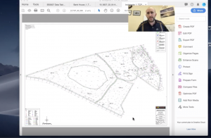
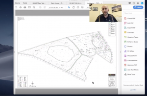
ROAVR Provide all clients with a personal video walkthrough of your quote. This means that you can easily understand our quotes and apply any changes instantly and we constantly receive 5* for this service.

ROAVR provides incredible aerial imagery to support your project. This imagery helps all project stakeholders fully understands the constraints and opportunities the site presents.
Email Support for Clarifications – Never feel stuck or confused — get detailed answers to your questions without jumping through hoops.

Need a quick quote or response?
No problems, let us know your timescale and we will upgrade you with ROAVR Accelerate.
We have dedicated staff at HQ preparing quotes daily - no waiting for the tree surgeon to get home.

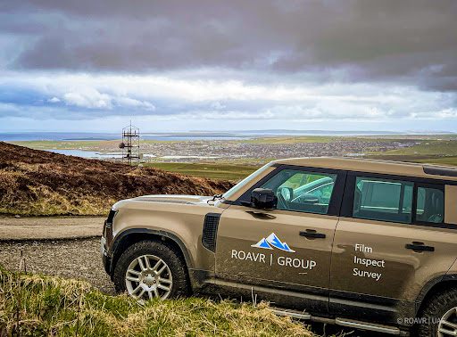
UK Wide service - our managed services operate nationwide from bases across the U.K. We can assist with your entire portfolio meaning you no longer need to commision multiple consultants and contractors, no travel time charged.
No we are not coming to you from Inverness!
Unless you live in Scotland of course ;)
Our SURVEYORS are fully equiped and can access state of the art equipment from 3D scanners to drones.
We provide a one stop shop for your project to minimise commisions, paperwork and most importantly, managment time.

The Only Service In The UK To Have A Dedicated App To Support Our Customers!
How cool is that?
ROAVR has developed our own app to support our customers through their planning journey.
All customers get access on booking with access to hours of resources and information to ensure you keep your planning on track.
RATED 4.9/5.0 On Google
YOur Next StepS ARE SimPLE
REQUEST A QUOTE
Use our simple pricing tool or request a quote, get a crystal-clear cost within the hour so you can move forward without delay.
Get Booked In
We confirm your survey date fast, with priority slots available, keeping your planning timeline on track.
GET APPROVED FASTER
Receive planning-ready survey data within days, engineered to support smooth submissions and confident design decisions.
RATED 4.9/5.0 On Google
YOUR QUESTIONS ANSWERED
What is a topographical survey and why do I need one for my planning application?
How much does a topographical survey cost?
How quickly can you carry out a topo survey?
What’s included in your topographical survey?
Is your survey data accurate enough for planning and design?
Can you liaise directly with my architect or planning consultant?
Is the survey safe to carry out on-site?
Do you offer topo surveys for both small and large sites?
How do I get started?
What sets your topo survey service apart from others?
RATED 4.9/5.0 On Google

ROAVR GROUP - THE Survey Company.
ROAVR Group, (HQ) Marr House,
Beechwood Business Park,
Sir Walter Scott Drive,
Inverness, IV2 3BW
Scotland: 01463 667 302
ROAVR Group - LONDON
85 Great Portland Street
W1W 7LT
London & The SE: 0203 633 7902
Rest of UK: 0121 816 1086
RATED 4.9/5.0 On Google
For land surveys near you, boundary surveys, topographical surveys and drone land surveys, ROAVR Group has you covered.